We are

This month, we’re looking back at how transportation has evolved over time in the SoHo Broadway corridor, from the pasture roads to the introduction of bus lanes along the Broadway corridor. Before colonization and industrialization, Broadway was originally the Wickquasgeck Trail, which started at what is now the Battery and ended at Sleepy Hollow. Under Dutch rule, the trail was widened and quickly became the main arterial road on the the southern tip of Manhattan.
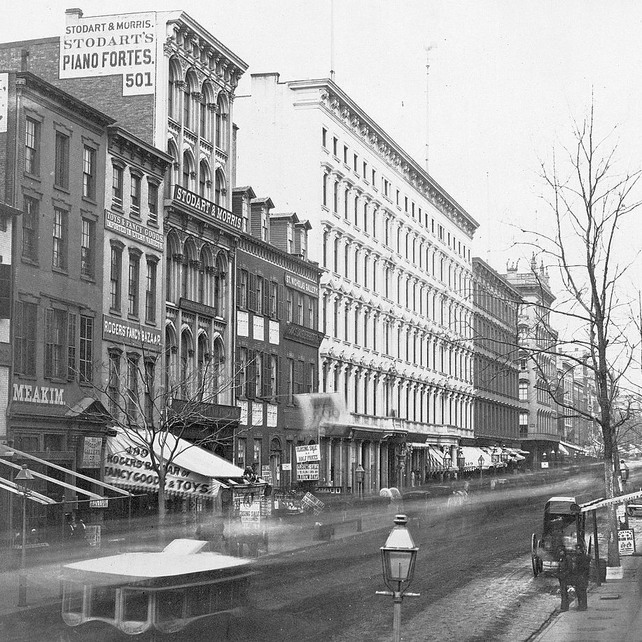
In the 19th century, surface transit developed along Broadway, beginning with horse-drawn ominbus lines, later replaced by horse-drawn streetcars, steam-driven cable cars, and finally electric trolleys in 1909.
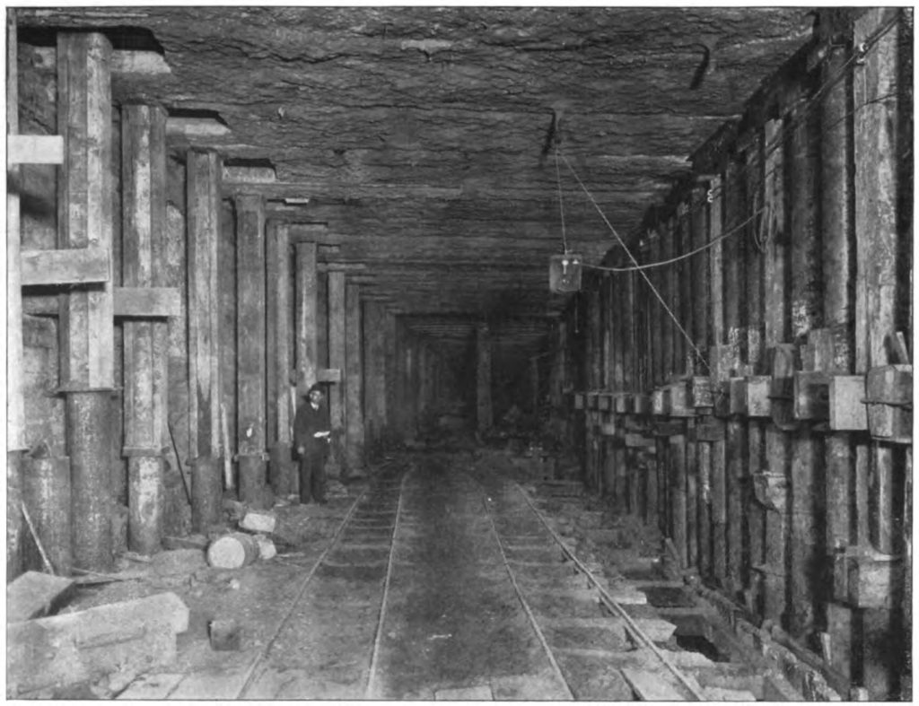
As New York pushed to expand the boundaries of development north in the 1870s with the near-completion of Central Park and a booming population, ideas of developing a subway line became popularized. The first subway line, operated by the Interborough Rapid Transit Company (IRT), extended from City Hall in Lower Manhattan to 42nd Street in Midtown.
Shortly after the IRT’s initial success in 1904, the IRT and Brooklyn Rapid Transit Company (BRT) signed dual contracts with the city to expand its subway service to more New Yorkers. By 1917, the Prince Street subway station was constructed as part of the BMT Broadway Line, which was a joint project between the IRT and BRT companies. The expansion of the subway line on Broadway proved to be critical for SoHo’s manufacturing companies in the early 1900s and later supported the district’s evolution into a renowned arts community in the 1970s.
In 2007, the NYC Department of Transportation announced that they would establish a bus-only lane on Lower Broadway, extending from Houston Street to Vesey Street. The bus lane extension was part of DOT’s Lower Broadway Transit Priority Plan, which was initially put forth to mitigate congestion from the construction of the Fulton Street Transit Center. Today, the bus lane remains along SoHo Broadway, cementing a transit-forward vision for the corridor. Bulbouts allow for a seamless loading/unloading process of passengers and slower traffic speeds, while creating much needed room for pedestrians on the street.
What does the future hold for transportation in the corridor? The Initiative is looking forward to seeing the impact of congestion pricing on our local streets, and is currently undertaking a Public Realm Vision and Framework Plan process for the district. Congestion pricing, which will establish a congestion fee on vehicles entering Manhattan below 60th Street, may potentially change traffic patterns in Lower Manhattan by incentivizing the use of public transportation and carpooling. If successful, congestion pricing would reduce vehicular traffic along the SoHo Broadway corridor, creating new opportunities for the use of public space. As an outcome of the Initiative’s public realm vision and framework plan based on stakeholder input, we are working to identify locations along local streets where the infrastructure can be strengthened for pedestrians, cyclists, and public transportation.
Top image: Broadway and Broome Street in 1855 via getty.edu